Home»Iceland_2016»Detifoss, Melrakkasletta, Asbyrgi
Visitors 18
Modified 28-Apr-17
Created 24-Apr-17
100 photos
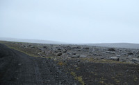
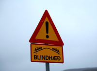
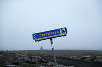
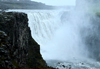
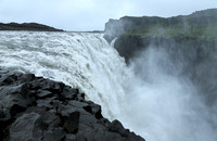
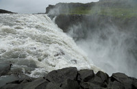
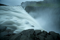
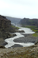
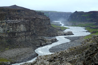
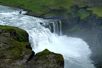
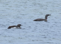
These places are to the north and/or east of the Myvatn region in some of the remoter regions of Iceland. The waterfall Detifoss, like its neighbors, Selfoss and Hafragilsfoss, is on the Jökulsá á Fjöllum river. This large glacial river flows out from the north side of the enormous Vatnajökull ice-cap (~10% of the land surface of Iceland). We have not been lucky with the weather on our visits to Detifoss, and this part of Iceland seems to attract foul weather. Downstream of Detifoss and the other waterfalls is the Ásbyrgi canyon. This is thought to have formed due to catastrophic floods of the Jökulsá á Fjöllum caused by a volcanic eruption under the icecap. Despite these violent beginnings, the Ásbyrgi canyon is a serene and verdant valley in these northern regions of Iceland. The Melrakkasletta peninsula is the most northerly on the mainland of Iceland. We came here to "reach" the Arctic Circle, as the northernmost point of Melrakkasletta lies within 1 km of that line. Getting to Melrakkasletta involved driving on isolated roads along the shore, passing through great breeding colonies of Arctic Terns, redshanks and other shorebirds, past ponds populated with Red-throated Loons, and seashores hosting multitudes of Eider ducks and ducklings. Out in this seaside tundra, you really felt you were in an arctic land.
Category:
Subcategory:
Subcategory Detail:
Keywords: